Is the Sea Nice in Nha Trang Today? A 0-10 Beach Score
Check the Nha Trang sea today: the tool below turns wave, wind, rain and UV data into a 0-10 reference score for the bay. Underneath, you will find what each score suggests, what a forecast cannot tell you and ideas for rough-sea days.
Written by Tụi mình mê biểnPublished Updated
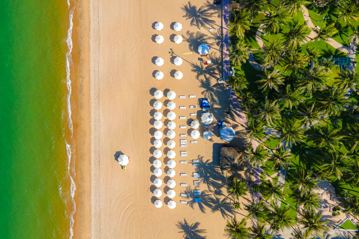
Photo: Hoàng Thạch · CC BY-SA 2.0 · Wikimedia Commons
🌊 Is the sea nice in Nha Trang today?
A reference score built from Open-Meteo wave, wind, rain and UV data
Updating sea conditions…
⚠️ This score is for reference only. Before swimming, check the warning flags on the beach, follow lifeguard instructions and keep an eye on official forecasts - in the rough season (Sep-Dec) the sea can change quickly.
Before a beach day, the usual question is simple: what is the Nha Trang sea like today? Is it worth walking down to Tran Phu beach, and will tomorrow's island boat leave? The tool above shows the weather and the waves at the moment you open the page. The rest, which is how to read that number against your own plans, is below.
A swim, a boat ride to the islands and a snorkel over coral each need different conditions. The same score of 6 can mean a pleasant swim close to shore inside the buoys and an uncomfortable speedboat ride for anyone prone to seasickness. So beyond the total, it pays to look at each reading.
How the beach index is calculated #
The tool combines wave, wind, rain and UV data from Open-Meteo into a reference score. You can look at each reading to see which factor is pulling the result up or down. The data comes from a single point in the middle of Nha Trang Bay, updates hourly and reloads every time you open the page.
Each time, the score starts at 10 and loses points factor by factor. A mild factor costs 1 point, a stronger one 2 or 3, and a thunderstorm costs 4 on its own. The scale stops at 0, so a day with heavy rain, big waves and thunder simply lands on zero.
Rain counts twice: once for the amount that has fallen and once for the sky conditions. That is why a heavy downpour drags the score down quickly even when waves and wind are still light. If wave data is unavailable, the Waves box shows a dash and the score comes from the weather alone.
The score reflects one moment in the day. For the rhythm of the whole year, our best time to visit Nha Trang guide has a month-by-month climate table: the dry season (January to August) usually brings a calm sea, while in the rainy season (September to December) wind and waves can change within hours.
What each score suggests #
The score is a starting point, not a substitute for looking at the beach itself. Here is how to read each band, and what to check before you decide.
8-10: fairly favorable conditions
Low waves, light wind, little rain. These are usually good days to plan a Nha Trang island hopping tour: pickup tends to come between 8:15 and 9am, boats leave from Cau Da port and you are back around 4pm. Whether the boats sail is still up to the port authority and your operator, so confirm before pickup.
For snorkeling, pick a tour to one of the 4 water areas where diving is being piloted; Hon Mun has been closed to swimming and diving since June 2022. If you stay on land, Tran Phu beach on mornings like this is usually clear and calm, with locals swimming from first light. High scores often come with fierce sun, so avoid 10am-3pm and still check the flags before getting in.
6-7: check the waves, the wind and the beach itself
Usually one factor is pulling the score down: wind picking up, heavy cloud, light rain or waves above 0.8 m. See which reading is low. If it is waves or wind, look at the flags and ask the lifeguards before you swim, and stay inside the buoys. Mornings are usually more pleasant than afternoons.
Island tours may still run, but if you get seasick, ask your operator about conditions, take medicine about 30 minutes before boarding and choose a morning departure. When the afternoon wind rises, switch to food: a bowl of fish-cake noodle soup, a plate of banh can, then a stroll along the seawall. Places to eat are in our what to eat in Nha Trang guide.
4-5: think twice, favor dry land
Waves or wind are strong enough to make the beach less pleasant, and rain may come in bursts. Only swim if the beach is open, lifeguards are on duty and you are a confident swimmer. Island tours are more likely to be delayed or rerouted, and the water is often too murky for good snorkeling.
This score suits a mud bath, the Po Nagar towers or the Oceanographic Museum. Details are in the backup plan section below.
Under 4: better to stay ashore
A score this low usually means heavy rain, strong wind, waves above 1.5 m or thunderstorms, so stay out of the water. Island boats are unlikely to sail; if someone still offers to take you out in these conditions, say no. Move the beach day to later in the week and give today to cafes and museums.
How rain, waves, wind, UV and storms change things #
Each factor affects each activity differently. Knowing which one is pulling the score down helps you decide more precisely than the total on its own.
Rain
Light rain does not ruin a swim; the beach often empties out. Heavy rain is another matter: it muddies the water, especially near river mouths, and underwater visibility drops. For snorkelers, last night's downpour can matter more than the drizzle happening right now.
Waves
Waves are usually the factor that matters most. Below 0.8 m the bay is fairly calm, although kids in the water still need an adult right beside them. Between 0.8 and 1.5 m boats start to roll and swimming near shore calls for more care. Above 1.5 m a swim stops being pleasant and an island boat becomes hard work for everyone on board.
Wind
Strong wind chops up the surface, speedboats slam from wave to wave and anyone prone to seasickness suffers most. Paddleboards and kayaks get pushed offshore faster than you expect, so on days with wind above 20 km/h it is best to leave them for another time.
UV
UV in Nha Trang climbs early in the day, even when it is a little cloudy. It does not make the sea more dangerous, but a whole midday on an open boat deck makes sunburn very likely. Put on reef-friendly sunscreen before getting in the water, wear a hat and drink plenty.
Thunderstorms
Thunder is the only factor that costs 4 points at once. On an open beach or out at sea, you are the tallest object around. Hear thunder, get out of the water and under a roof, and wait until the storm has fully passed.
How the Nha Trang sea changes through the year #
From January to August the sea is usually calmer, with February to April the driest stretch of the year. May to August bring stronger sun, warm water and long days. Many dive operators also rate February to August as the clearest water for snorkeling, though that is trade experience rather than an official measurement.
The rainy season is a different story. October and November are the wettest months, and December is still fairly wet. Rain tends to come in spells, a drenching day followed by a few bright ones, so the morning score can look nothing like the afternoon. In October 2025 local authorities issued a high-wave warning for all activities at sea off Nha Trang.
Midyear adds something no forecast can measure: fire jellyfish. In July and August 2026 they turned up in numbers around Hon Mun and Hon Bac, causing burning, blisters and, in bad cases, dizziness and trouble breathing. A 10-point sky can still cancel your swim. If you get stung, get out and find a lifeguard; skip the folk remedies.
Rip currents run all year, including the good season. A rip often looks like a calmer, flatter strip of water between breaking waves, which is exactly why visitors mistake it for the safe spot.
How the main beaches differ when the waves are up #
Not every beach responds the same way to the same score. The data comes from a point in the middle of the bay, so treat the score as the general picture and adjust for the beach you are heading to.
Tran Phu beach is the public strip running about 5 km along the city center, with buoyed swimming zones and lifeguards on duty. On moderate days it is the more reassuring choice because someone is always watching. On rough days the lifeguards raise flags and keep people out; do as they say.
Hon Chong, north of the center, is a pile of boulders at the water's edge, VND30,000 to enter and 30-45 minutes to see. It is a place for views and photos rather than swimming. When the sea is up, waves wash over slick rock, so stay back and do not climb out onto the outer boulders for a better angle.
Bai Dai, to the south, is long, open and faces straight out to sea with little shelter. A beach far from the city is not necessarily calmer. When the tool shows waves above 1.5 m, it is not worth driving down there to swim.
Doc Let is 46-49 km north, with gently shelving white sand, shallow water and usually smaller waves than downtown, which makes it good for families with small kids. Bear in mind the data comes from Nha Trang Bay, not Doc Let, so check with someone there before driving nearly 50 km.
For how to get to each beach and where to park, see things to do in Nha Trang.
Flags and lifeguards outrank any forecast #
These reminders have a reason behind them. In just 6 days of mid-February 2026, lifeguards on Nha Trang's beaches assisted 20 swimmers, 5 of them needing emergency care, mostly because of rip currents. From the shore, the sea looked harmless those days.
A few simple rules help. Red or black flag up means you stay on the sand, even if the tool says 9. Never swim beyond the buoy line. Do not swim after drinking or a heavy meal. Children in the water need an adult right next to them, not watching from a sun lounger.
If a current does pull you out, do not fight it by swimming straight back to shore. Stay calm, swim parallel to the beach until you are out of the pull, then head in, and raise an arm to signal the lifeguards.
Backup plans for a rough-sea day #
A rough-sea day in Nha Trang can still be a good one. When the score drops below 5, here are a few options on dry land.
Mineral mud baths. I-Resort, about 4 km from the center, opens 8am-5:30pm and stops selling tickets at 4:30pm. The Thap Ba mud bath center at 438 Ngo Den street is the other long-standing option. Warm mud during a light drizzle is surprisingly pleasant, and weekday mornings are much quieter than weekends.
Po Nagar towers. The Cham temple complex on Cu Lao hill costs VND30,000 and takes 1-2 hours. Cover your shoulders and knees for the tower area. Hon Chong is close by, so the two fit into one outing if the rain lets up.
Oceanographic Museum. It holds over 20,000 specimens and tanks with more than 300 marine species, and adult tickets cost VND40,000. Some galleries show their age, but on a wet day it is still a sensible choice, especially with children.
Cafes, the market and food. Watching rain sweep across the bay from a seafront cafe is its own way of seeing Nha Trang. The new Dam market is open by day for dried seafood and fish sauce to take home; the old round market building has closed. In the evening, go for seafood or a plate of hot banh can.
In September and October there is also the sunrise cloud hunt on Hon En mountain, best between 4 and 6am, but do not ride up while it is raining because the last stretch is steep. VinWonders works even when the sea is rough, although the cable car can pause in bad weather and be replaced by boats. For backup days across a whole trip, see the Nha Trang travel guide.
What a forecast cannot tell you #
The tool uses data from one point in the bay, and the sea is not uniform. A sheltered cove can be glassy while a rocky headland takes a beating. Forecast wave height is an offshore average, so the waves breaking on the sand can be bigger.
Four things never show up in a forecast: rip currents, jellyfish, water clarity and sailing bans. Island boats run on the port authority's decisions, not on a single weather point, so a high score does not guarantee a departure and a low score is not an official ban. Always confirm with your operator before pickup.
The score is also a reading for the current hour. In the rainy season, 7 at 7am and 3 at 2pm is fairly common, so reload the page right before you head out instead of relying on a screenshot from last night.
Where the data comes from #
All weather and wave numbers in the tool come from Open-Meteo (Weather data by Open-Meteo.com), an open-data service published under the CC BY 4.0 license. The tool runs in your browser, needs no account and does not store any personal data.
The share button sends today's score with a link to this page, handy when the whole group needs to agree on plans. Still torn between islands? Try our which Nha Trang island are you quiz for fun.
FAQ #
How often is the data updated?
Open-Meteo refreshes its forecasts hourly, and the numbers reload every time you open or refresh the page. For the latest reading, just reload.
Why was my island tour cancelled even with a high score?
Island boats run on the port authority's decisions: when a sailing ban is issued, boats stay ashore even if the weather at the measuring point looks fine. The reverse also holds; a low score here is not an official ban. Confirm with your tour operator before departure.
Does a low score mean swimming is forbidden?
No. This is a reference tool with no official standing. The final word belongs to the flags, the warning signs and the lifeguards on the beach; official storm and rough-sea warnings are issued by nchmf.gov.vn.
What is the best time of day to swim in Nha Trang?
Usually early morning, before about 9am: the sea tends to be calmer, the sun is gentler and Tran Phu beach is full of locals swimming. Avoid 10am-3pm when UV peaks, and in the rainy season reopen the tool right before you go, since wind and waves change by the hour.
Does the score work for Doc Let or Diep Son?
Only as a general guide. The data comes from one point in Nha Trang Bay, while Doc Let is 46-49 km north of the center and Diep Son is further north still. Check with someone local before going; Diep Son also depends on the tide times.
📚 Sources
Information in this article draws on the sources below, as of the update date.
- Open-Meteo: hourly weather and wave forecast data (CC BY 4.0)
- Vietnam National Centre for Hydro-Meteorological Forecasting: official marine forecasts and warnings
- Khanh Hoa newspaper (2/2026): Nha Trang beach safety notes, 8 designated safe swimming zones
- Khanh Hoa newspaper (10/2025): high-wave warning for activities at sea off Nha Trang
- CafeF (8/8/2026): fire jellyfish stinging swimmers in Nha Trang
- Open-Meteo ERA5 2015-2024: Nha Trang monthly rainfall (compiled 28/9/2026)
- Dan Tri (28/9/2026): Nha Trang under a sea of clouds at sunrise
- Oceanographic Museum - baotanghdh.vn: official ticket prices (accessed 28/9/2026)