Looking at a Nha Trang Map, Where Should You Stay?
If your saved hotels and attractions are scattered across the screen, choose an area first. A room near the airport creates a different daily trip from one near the central square.
Written by Tụi mình mê biểnPublished Updated
Nha Trang is not the entire resort coastline around Cam Ranh Airport. Booking searches often place both under the same destination name, but staying near the airport and visiting town every day is a very different trip from staying near the central square. We use a Nha Trang map to choose the area first, then arrange sightseeing and compare rooms.
Use Tram Huong (Trầm Hương) Tower beside 2 April Square as a reference point. The sea is east, the urban area follows the coast, the Cai River (sông Cái) is to the north, and Cau Da (Cầu Đá) is south. You do not need to memorize every street. Establish where your hotel sits relative to that landmark and which direction each outing takes.
Nha Trang belongs to Khanh Hoa (Khánh Hòa) #
After the provincial merger, Khanh Hoa includes the former provinces of Khanh Hoa and Ninh Thuan (Ninh Thuận). Nha Trang remains in Khanh Hoa; Phan Rang and Vinh Hy (Vĩnh Hy) are also in the enlarged province. Sharing a province does not make two places close enough for a quick outing before lunch.
Distinguish Nha Trang as the familiar urban destination from the administrative ward bearing the same name. Addresses around the area also use Bac Nha Trang (Bắc Nha Trang), Nam Nha Trang, and Tay Nha Trang (Tây Nha Trang). For a pickup, send the property name, street number, street, and map pin instead of only the ward.
On the national map, Nha Trang lies east of Da Lat (Đà Lạt), northeast of Ho Chi Minh City (Thành phố Hồ Chí Minh), and far south of Hanoi (Hà Nội). A sample road calculation from the tower to central destination pins gives roughly 412 kilometers to Ho Chi Minh City, 141 kilometers to Da Lat, and 1,274 kilometers to Hanoi. These are example driving routes, not straight-line distances or the length of every possible journey.
For Ho Chi Minh City, the road length depends on the expressway or highway route and your exact endpoint. The intercity routing link under further information lets you replace the destination. For a short vacation, compare usable arrival times and the full transfer before combining cities simply because the distance appears manageable.
Divide the coastline into five practical areas #
Central Tran Phu (Trần Phú)
The square, waterfront, and streets behind it
This is our choice for a first visit without a scooter. People in the group can eat, walk along the waterfront, and return to their rooms without arranging a car together. Save the tower location, then check whether your hotel entrance faces a main street or sits inside an alley.
Near the beach does not describe the actual walking route. Check the crossing, entrance, and vehicle stopping point. A room farther behind the waterfront can suit walkers, while someone with a stroller or heavy luggage needs to inspect access more carefully.
North across the river
Po Nagar (Tháp Bà Po Nagar) and Hon Chong (Hòn Chồng)
The northern cluster includes Po Nagar and Hon Chong. We put them in the same outing if the group has the energy, rather than crossing north twice with a southern museum visit in between.
This remains an urban area with buildings and services. If staying here, budget for rides to central dinner plans. It suits travelers happy to spend time in the north more than people expecting to walk around the central square every night.

Vinh Hoa (Vĩnh Hòa) and farther north
A familiar area name that needs a precise pin
Vinh Hoa is an older locality name still used in accommodation descriptions; addresses in this area now use Bac Nha Trang ward. The northern strip is not a single point. We use a reference near Vinh Hoa school on Ngo Van So (Ngô Văn Sở) Street for the distance table, not as a sightseeing recommendation.
Farther north means planning transport for southern outings. Add several return rides before comparing the total cost of two hotels. Open the map wide enough to see both the accommodation and the central square, rather than judging a listing only by the beach immediately in front of it.
Bai Dai (Bãi Dài) toward Cam Ranh
The resort coastline south of town
Bai Dai suits a stay built around one resort. It is not a walkable extension of the central hotel strip. We would choose it when the accommodation is a major part of the holiday, then set aside a separate outing for town.
The airport is in this southern direction too, but a general beach pin does not locate every resort entrance. Send the full property name when arranging a ride. A hotel being close to the airport, or using Nha Trang in its branding, does not establish that a shuttle is included.
The islands in the bay
A separate water connection
Hon Tre (Hòn Tre), Hon Tam (Hòn Tằm), and Hon Mun (Hòn Mun) lie offshore. Their pins establish location, not whether a particular sailing is operating or swimming is permitted. Ask for both the mainland boarding point and the actual island destination when booking.
Board only when departure is authorized, wear a life jacket, and avoid alcohol before and during the trip. Pregnant travelers, people with medical conditions, and families taking small children should ask a doctor about suitability. Postpone during thunderstorms, heavy rain, or dangerous-weather warnings. A straight line across the map is not a useful sailing-time estimate.
Use the same starting point for every comparison #
The road distances below are rounded from open-map car routes starting at the tower. The time column is what we would allow for the ride and pickup or drop-off, not a live traffic estimate. A hotel’s use of the word central does not replace this fixed starting point.
| Destination and pin | Sample road distance | Our time allowance |
|---|---|---|
| Nha Trang Station | 1.8 km | 15-20 minutes |
| Long Son (Long Sơn) Pagoda | 2.4 km | 15-25 minutes |
| Po Nagar | 3.9 km | 20-30 minutes |
| Hon Chong | 4.2 km | 20-30 minutes |
| Oceanographic Museum (Bảo tàng Hải dương học) | 4.4 km | 20-30 minutes |
| Vinh Hoa reference on Ngo Van So Street | 7.4 km | 30-40 minutes |
| Cam Ranh Airport | 38.3 km to the airport pin | 60-75 minutes, excluding airport procedures |
An airport-area pin can differ from the actual terminal entrance. Replace it with your terminal when booking a car. The same distinction applies to a temple or museum: its mapped center is not necessarily the gate accessible to a vehicle or the permitted visitor entrance.
Choose the cluster before requesting a ride #
A central outing can begin near the station, include Long Son, and finish by the waterfront. A northern outing can combine Po Nagar with Hon Chong. Give the southern side to the museum. We choose one cluster per half-day and eat along that route instead of crossing town to a saved restaurant between every stop.
Which attractions deserve your time is a different question from which ones sit close together. Two nearby pins may still be unsuitable for the same traveler if one requires steps and the other involves slippery rocks. Short distances do not remove mobility considerations.
Deciding when to walk and when to use a car depends on the real route, luggage, and weather. In rain, arrange a legal pickup near shelter when available. Do not walk through floodwater simply because the navigation app continues to display a road.

Photo: L.K.Phung
Save named entrances instead of one wide screenshot #
Make a list containing your hotel, transport terminal, tour pickup, and sightseeing clusters. Add the entrance or meeting landmark to each note. Download the map area for offline use before traveling, and save accommodation contact details separately. A location pin alone may not include the help you need after a late arrival.
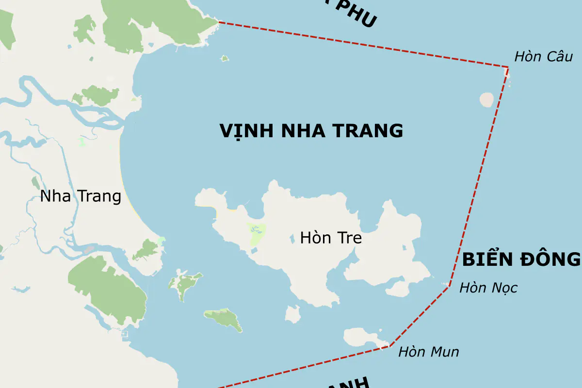
The bay map used as the cover shows coastline and island positions. It was made from older data, so it is not a current ward-boundary or road-status map. A live map helps locate a place; the site’s operating notice determines whether visitors can enter or boats can leave.
Once you have chosen an area, the accommodation-area choices help compare rooms within it. Build the locations into a four-day plan with one trip outside town, keeping the final morning close to luggage collection rather than adding a distant pin just because the calendar still has space.
Should I send the driver a street pin or a hotel pin?
Send the entrance pin and full hotel name. For a name used by several properties, add the street number or an entrance photo supplied by the hotel.
Can I walk between two pins that look close together?
Check the walking route, crossings, bridges, and entrances. Screen distance does not establish a continuous public walking route.
Does an attraction pin show the parking area?
Not necessarily. Ask the attraction for the permitted parking location and save it separately, especially with a car or a traveler who needs a close drop-off.
Related posts
Guides
Nha Trang with Kids: What to Know Before Taking the Family
Choose the room, rest schedule, and two main outings before filling a family itinerary in Nha Trang.
Tools
Sunrise or Sunset in Nha Trang: Which Should You Plan For?
Choose a sunrise or sunset outing in Nha Trang using local times, viewing direction, and the forecast around each event.
Guides
When Should You Visit Nha Trang Photo Spots for Better Light?
Arrange Nha Trang photo stops around light, access, and the time you can actually spend taking pictures.